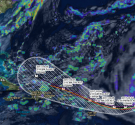
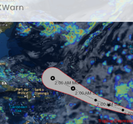
Hurricane Irma is now a major hurricane with winds of 115 mph and the storm is expected to strengthen for the foreseeable future. Irma is expected to strengthen over the coming days to at least a category 4 storm with winds on Wednesday predicted to be near 140 mph. The […]
Hurricane Irma was upgraded today to a category 2 storm giving it winds of 100 mph. Irma is expected to strengthen over the coming days and will likely become a major hurricane making it an extremely dangerous storm. This storm could potentially have impacts to the islands in the Caribbean […]
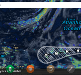
Tropical Storm Irma formed in the Atlantic late Wednesday morning and will likely become a hurricane by the weekend. The storm currently has maximum sustained winds of 50 mph and is moving west at 13 mph. Though it is too early to know if this system will impact the United […]
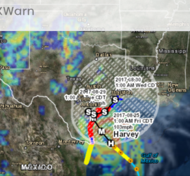
SUMMARY OF WATCHES AND WARNINGS IN EFFECT: A Storm Surge Warning is in effect for… * Port Mansfield to High Island Texas A Storm Surge Watch is in effect for… * South of Port Mansfield Texas to the Mouth of the Rio Grande A Hurricane Warning is in effect for… […]
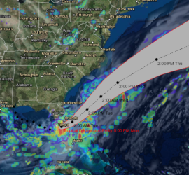
BULLETIN Tropical Depression Emily Advisory Number 4 NWS National Hurricane Center Miami FL AL062017 500 PM EDT Mon Jul 31 2017 …EMILY WEAKENS TO A DEPRESSION OVER CENTRAL FLORIDA… …HEAVY RAINFALL STILL POSSIBLE ACROSS SOUTHEASTERN FLORIDA… SUMMARY OF 500 PM EDT…2100 UTC…INFORMATION ———————————————- LOCATION…27.8N 81.7W ABOUT 30 MI…45 KM NW […]
Tropical Depression Four formed in the Atlantic Ocean early this morning and it currently has max winds of 30 mph and is moving North West at 17 mph. This motion and speed is expected to remain constant over the next couple of days. At this time the storm is not […]
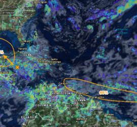
For the North Atlantic…Caribbean Sea and the Gulf of Mexico: 1. Satellite images indicate that an area of disturbed weather associated with a tropical wave is located about 1800 miles east of the southern Windward Islands. This disturbance has become better organized today, and additional development is possible during the […]
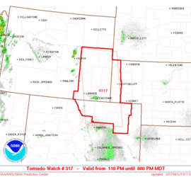
WW 317 TORNADO CO NE WY 121910Z – 130200Z URGENT – IMMEDIATE BROADCAST REQUESTED Tornado Watch Number 317 NWS Storm Prediction Center Norman OK 110 PM MDT Mon Jun 12 2017 The NWS Storm Prediction Center has issued a * Tornado Watch for portions of Northeast Colorado Western Nebraska […]
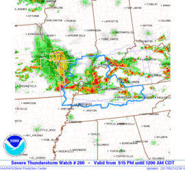
WW 280 SEVERE TSTM IL IN KY MO TN 272215Z – 280500Z URGENT – IMMEDIATE BROADCAST REQUESTED Severe Thunderstorm Watch Number 280 NWS Storm Prediction Center Norman OK 515 PM CDT Sat May 27 2017 The NWS Storm Prediction Center has issued a * Severe Thunderstorm Watch for portions […]
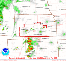
WW 239 TORNADO KS 182020Z – 190400Z URGENT – IMMEDIATE BROADCAST REQUESTED Tornado Watch Number 239…CORRECTED NWS Storm Prediction Center Norman OK 330 PM CDT Thu May 18 2017 CORRECTED TO INCLUDE PDS WORDING The NWS Storm Prediction Center has issued a * Tornado Watch for portions of PORTIONS […]
